Photographs
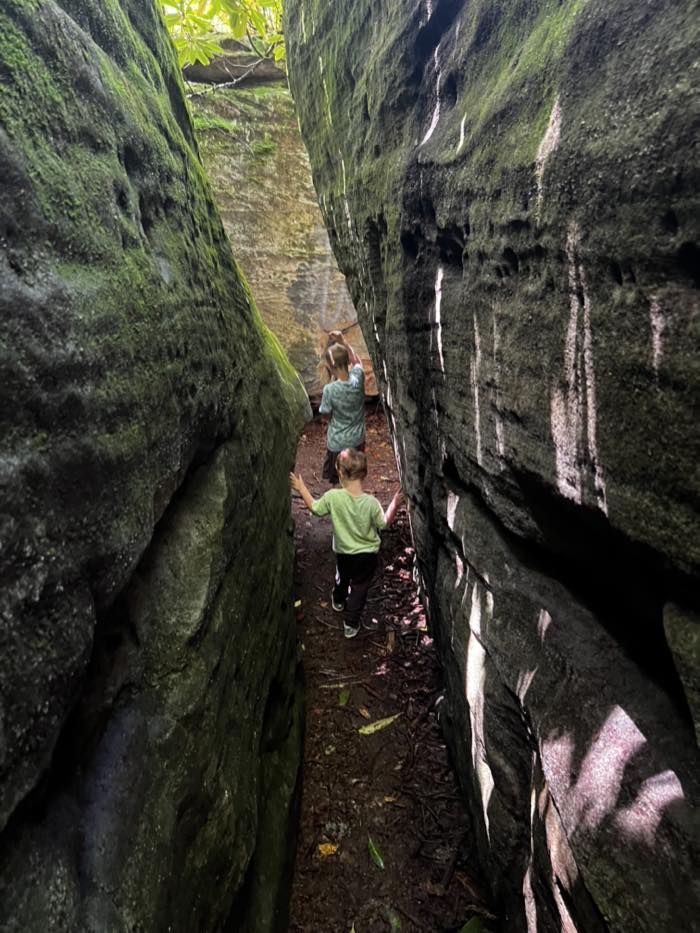 The passage itself. The walls are what the name is about, and the figures are there for scale — several of the gaps are barely shoulder-width.2026-08-03
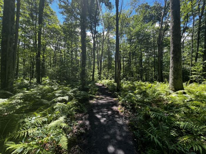 The approach: open hardwood and heavy fern cover before the ground turns to boulders.2026-08-03
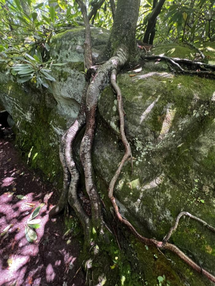 Sandstone under moss, with trees rooted straight over the rock. This is the surface the whole maze is made of — and why it stays slick.2026-08-03
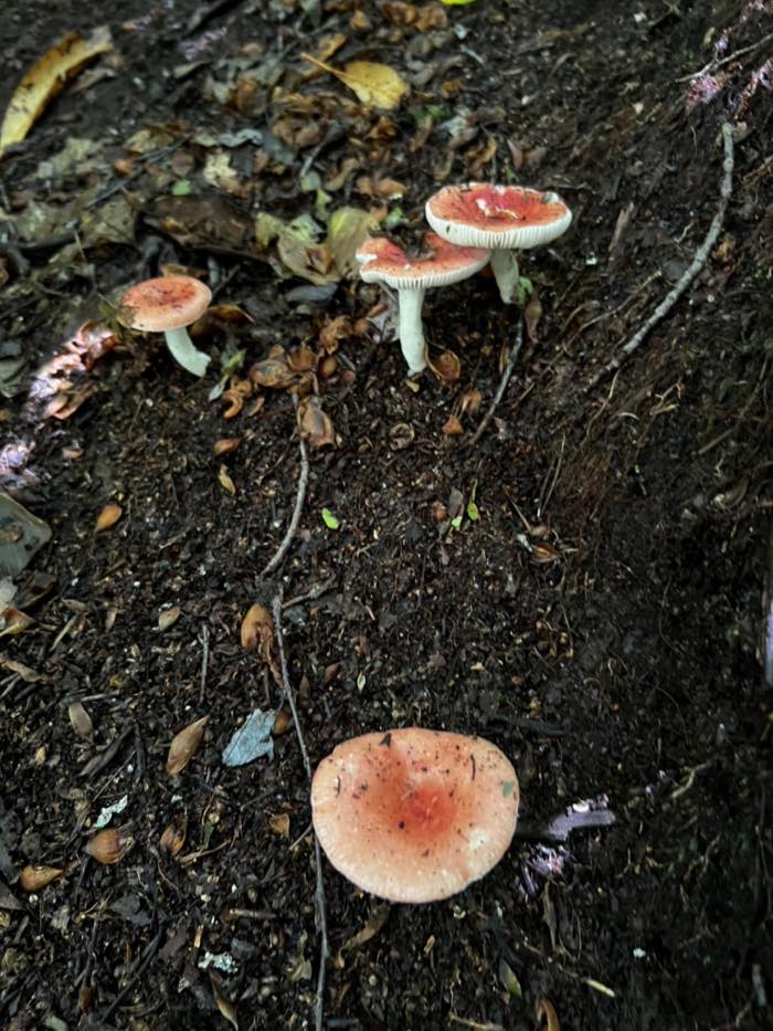 Russula on the forest floor in early August. Look, photograph, do not eat.2026-08-03
Not on Maryland DNR's list of parks requiring day-use reservations as of 25 June 2026.
A natural labyrinth of house-sized sandstone boulders, moss over every surface, with passages narrow enough to turn sideways for. It isn't a signed DNR trail and it isn't on the state forest's map. Locals know it, and that's mostly how you find it.
House-sized boulders with passages between them narrow enough to turn sideways for, and no sign anywhere telling you it exists. The moss holds water for days, so it's slick long after the rain stops. Not one to rush, and not one to do in trainers.
Matt, 3 Aug 2026
What's there
Facilities
4/14 confirmed- Waterfall
- No
- Beach
- Not confirmed
- Swimming
- Not confirmed
- Restrooms
- No
- Picnic areas
- Not confirmed
- Showers
- Not confirmed
- Camping
- Yes
- Cabins
- Not confirmed
- Trails
- Yes
- Boat launch
- Not confirmed
- Boat rentals
- Not confirmed
- Fishing
- Not confirmed
- Winter use
- Not confirmed
- Pets
- Not confirmed
Getting in
- Fee
- No day-use service charge listed for Potomac-Garrett State Forest on DNR's fee schedule. Not confirmed.
- Annual pass
- Maryland State Park and Trail Passport — $75 a year, $100 for non-residents. Covers day-use entry statewide. Where it can be bought in the county is not confirmed.
- Shop
- Not confirmed
- Hours
- Not confirmed
- Park office
- Not confirmedPotomac-Garrett State Forest headquarters — 1431 Potomac Camp Road, Oakland, MD 21550The forest is administered from the Potomac Camp Road headquarters. There is nothing at the trailhead.
From people who were there
The trailhead is a small parking area on Snaggy Mountain Road, near where it meets Cranesville Road. The walk in runs through open hardwood with heavy fern cover before it reaches the boulders.
Site maintainer, first-hand · reported 3 Aug 2026 · visited 3 Aug 2026
Bears on: trailhead, parking, approach
First-hand and useful, but not the same as the agency confirming it — so it doesn't change the stamp below. It changes what I go and ask.
Where it's
Field notes
What I saw on the day. Not checked with anyone, and it can go out of date faster than the facts above.
Field note · 3 August 2026 · Matt
The trailhead is a small pull-in on Snaggy Mountain Road near Cranesville Road. No sign, so you are looking for the parking area rather than the trail. The walk in is open hardwood with fern up to your knees, and then the ground turns to boulders fairly suddenly. Some of the passages are barely shoulder-width and everything is mossy, which means slick long after it has stopped raining. Not one to do in a hurry.
Were you just there?
Tell us what you saw
Anything you noticed. If it's wrong or it's changed, this is the fastest fix.
Still open — tap one
Got a photograph? The full form takes up to four.
The other parks
- Swallow Falls — state park, Oakland · reservation required
- Deep Creek Lake — state park, Swanton
- Herrington Manor — state park, Oakland
- New Germany — state park, Grantsville
- Big Run — state park, Grantsville
- Casselman River Bridge — state park, Grantsville
- All ten, side by side